
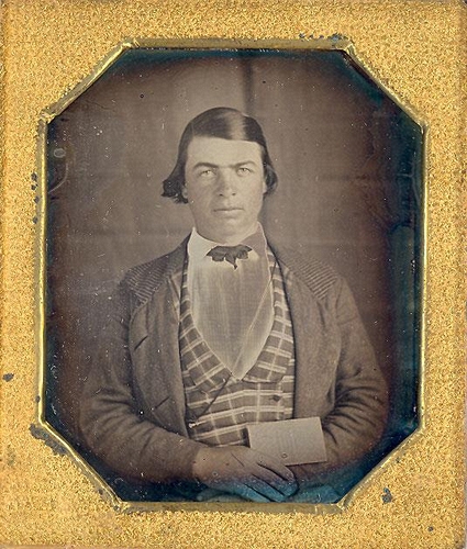
Man holding a Map of Mexico
1840s
Daguerreotype
Private collection of Graham Pilecki
LL/53141
1 of 57
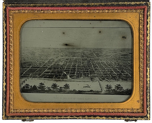
A Map of Terre Haute, Indiana
n.d.
Ambrotype, 1/4 plate
Cowan's Auctions, Inc
Dec 6th and 7th 2007, Western & Historic Americana, lot: 629
LL/61771 [Further details available]
2 of 57
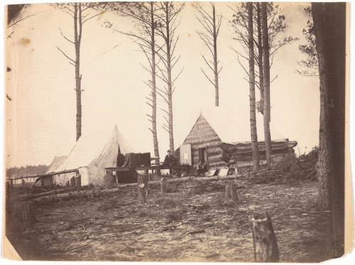
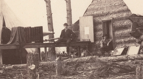
Copying Maps, Photographic Headquarters, Petersburg, Virginia
1865, March
Albumen print, from glass negative
19 x 24.6 cm (7 1/2 x 9 11/16 ins)
Metropolitan Museum of Art
Gilman Collection, Museum Purchase, 2005 Accession Number: 2005.100.1236
LL/53138
3 of 57
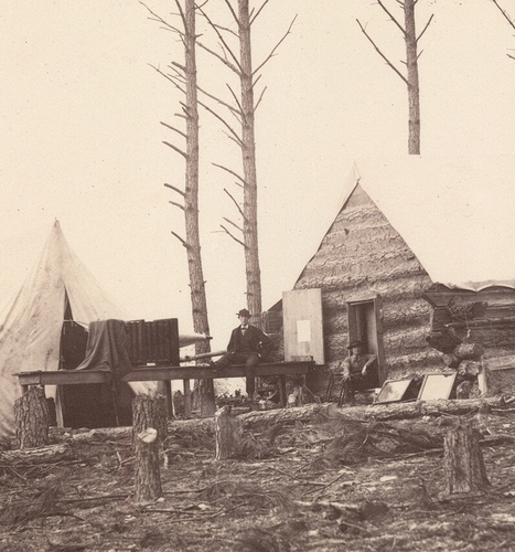
Copying Maps, Photographic Headquarters, Petersburg, Virginia
1865, March
Albumen print, from glass negative, detail
19 x 24.6 cm (7 1/2 x 9 11/16 ins)
Metropolitan Museum of Art
Gilman Collection, Museum Purchase, 2005 Accession Number: 2005.100.1236
LL/53139
4 of 57
Copying Maps, Photographic Headquarters, Petersburg, Virginia
1865, March
Albumen print, from glass negative, detail
19 x 24.6 cm (7 1/2 x 9 11/16 ins)
Metropolitan Museum of Art
Gilman Collection, Museum Purchase, 2005 Accession Number: 2005.100.1236
LL/53140
5 of 57
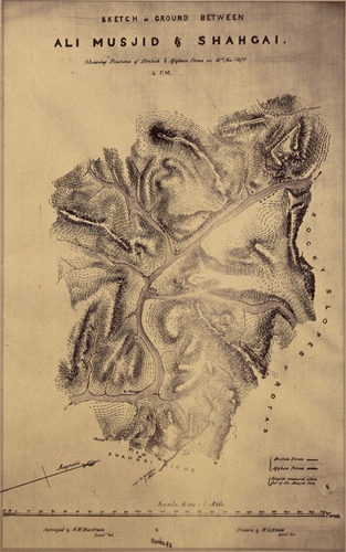
Sketch of Ground between Ali Musjid and Shahgai
[Afghan War 1878-79. Peshawur Field Force. J. Burke]
1878, 21 November
Albumen silver print
26.3 x 16.4 cm (10 3/8 x 6 7/16 ins)
J. Paul Getty Museum
Object number: 84.XO.1277.64
LL/62948 [Further details available]
6 of 57
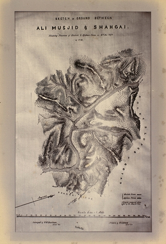
Map of the ground between Ali Musjid and Shahgai in the Khyber Pass, showing the position of British and Afghan forces on the 21st of November 1878 at 4.00pm
[Afghan War 1878-79 Peshawur Valley Field Force J. Burke.]
1878-1879
Albumen print
29.5 x 20.2 cm (image)
The Royal Collection
RCIN 250139
LL/93657 [Further details available]
7 of 57
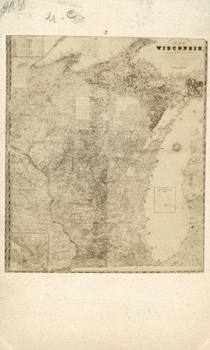
n.d.
Carte de visite
Wisconsin Historical Society
Increase Allen Lapham: Papers, 1825-1930, carte-de-visite collection, WHS Image id: WHi-47853
LL/32889 [Further details available]
8 of 57
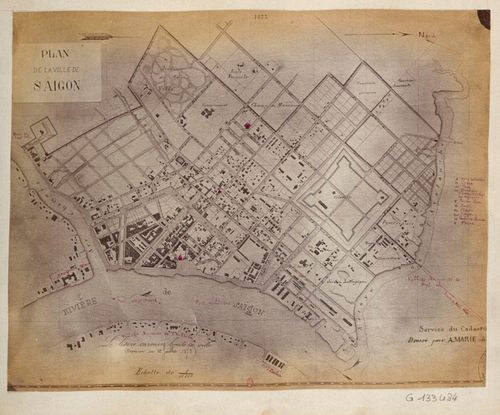
[Plan de la Ville de Saigon]
[Voyage de l'Égypte à l'Indochine]
n.d.
Albumen print
Bibliothèque Nationale de France, Département des Estampes et de la Photographie
4-UA-43, Identifier: ark:/12148/btv1b84515897, 31 of 99
LL/88359 [Further details available]
9 of 57

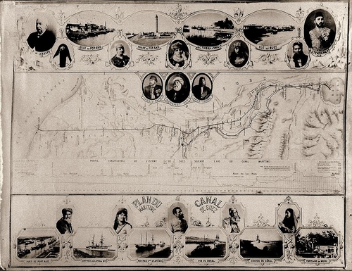
Plan du Canal de Suez
1870-1880
Albumen print
Bibliothèque Nationale de France, Département des Estampes et de la Photographie
Identifiant: ark:/12148/btv1b8443051d
LL/72950
10 of 57
Plan du Maritime - Canal de Suez
n.d.
Map
Descendents of Johan Støckel
LL/61958 [Further details available]
11 of 57

Suez Canal Map
1870 (ca)
Albumen print
7 1/2 x 9 5/8 ins
Archive Farms
LL/64937 [Further details available]
12 of 57
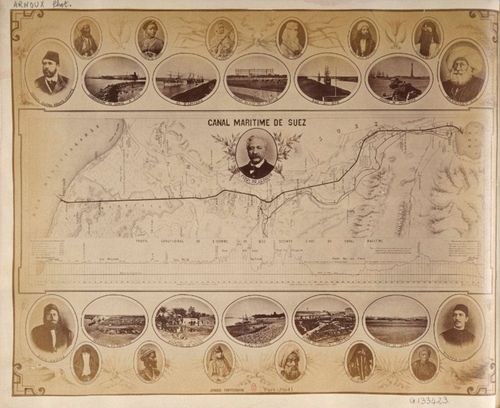
Canal Maritime de Suez
[Voyage de l'Égypte à l'Indochine]
n.d.
Albumen print
Bibliothèque Nationale de France, Département des Estampes et de la Photographie
4-UA-43, Identifier: ark:/12148/btv1b84515897, 10 of 99
LL/88346 [Further details available]
13 of 57
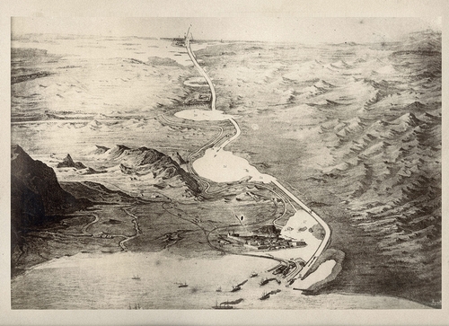
Suez Canal
1880s
Illustration
Private collection of Sergey Maximishin
LL/104681
14 of 57
[Temple floorplan]
[La Vallée Du Nil: Impressions et Photographies]
1859-1860 (taken) 1862 (print)
Albumen silver print, from a waxed paper negative
11.2 × 10 cm (4 7/16 × 3 15/16 in.)
J. Paul Getty Museum
Object Number: 84.XB.1233.86
LL/104008 [Further details available]
15 of 57

Recent excavations in Rome
1868, 30 December
Albumen print, map
Collection of Michael G. Jacob
LL/53525 [Further details available]
16 of 57
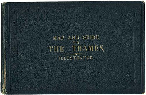
Book cover of "A New Map of the River Thames from Oxford to London" 1872 edition by Henry W. Taunt
1872 (published)
Book cover
Stereographica - Antique Photographica
Courtesy of Bryan and Page Ginns (#21 / 207)
LL/32953
17 of 57
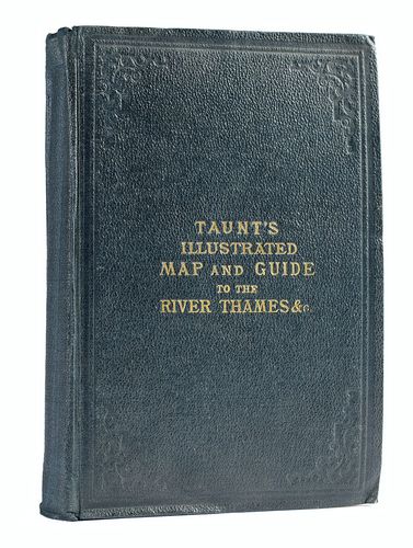
Book cover for Henry W. Taunt "Taunt's Illustrated Map and Guide to the River Thames &", Third edition (Oxford: [Henry W. Taunt & Co.]) n.d. (about 1878).
1878 (ca)
Book cover
Stockholms Auktionsverk
Photographica, 4 April 2011, Lot: 4317
LL/43519 [Further details available]
18 of 57
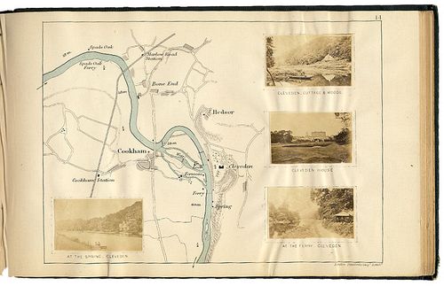
Page from "A New Map of the River Thames from Oxford to London" 1872 edition by Henry W. Taunt
1872 (published)
Book page
Stereographica - Antique Photographica
Courtesy of Bryan and Page Ginns (#21 / 207)
LL/32954
19 of 57
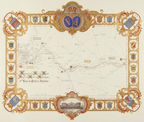
Chemin de Fer du Nord ligue de Paris a Boulogue. 1ere Partie de Paris a Amiens
[Itineraires et Vues du Chemin de fer du nord - Visite de sa Majeste la Reine Victoria et de son Altesse Royale le Prince Albert 18-27 Aout 1855]
1855
Watercolour, with gilding and salted paper print
43.7 x 56 cm (whole object)
The Royal Collection
RCIN 2584457
LL/93039 [Further details available]
20 of 57
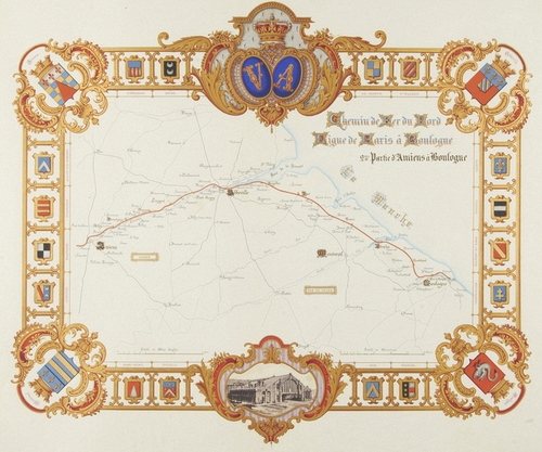
Chemin de Fer du Nord ligue de Paris a Boulogue. 2me Partie d'Amiens a Boulogue
1855 (map) 1890 (carbon copy of a salt print)
Watercolour, with gilding and carbon print
44 x 57 cm (whole object)
The Royal Collection
RCIN 2584458
LL/93040 [Further details available]
21 of 57

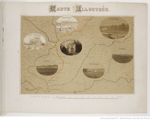
Illustrated Map (Carte Illustree)
1859 (after)
Albumen silver print, with applied colour
16 x 23.2 cm
National Gallery of Canada / Musée des beaux-arts du Canada
Gift of Benjamin Greenberg, Ottawa, 1980, No. 23941.1
LL/63223
22 of 57
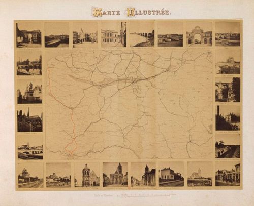
Carte illustrée [Illustrated map] for E. Baldus, 1866, Chemin de fer du Nord. Ligne de Paris à Compiègne par Chantilly. Petites vues photographiques
[Chemin de fer du Nord. Ligne de Paris à Compiègne par Chantilly. Petites vues]
1866
Map page
24 x 32 cm
Bibliothèque Nationale de France, Département des Estampes et de la Photographie
RESERVE8-VE-1427
LL/76053 [Further details available]
23 of 57
Carte illustrée for Édouard Baldus, 1860, Chemin de fer du Nord. Ligne de Paris à Boulogne. Album de vues photographiques
[Chemin de fer du Nord. Ligne de Paris à Boulogne. Album de vues photographiques]
1860
Photograph
Bibliothèque Nationale de France, Département des Estampes et de la Photographie
RESERVE FOL-VE-1368 (1), Identifier: ark:/12148/btv1b52507139d, 9 of 63
LL/88081
24 of 57
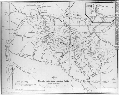
Map of the Klondyke and Indian River mining districts, drawn by E. Tappan Adney
1898
Lantern slide, Silver salts on glass - Gelatin dry plate process
10 x 12 cm
McCord Stewart Museum
MP-1979.111.45
LL/101069
25 of 57
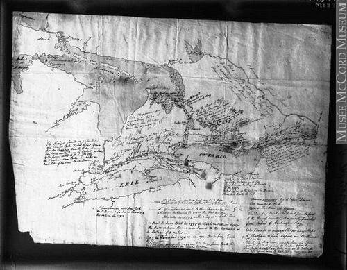
Simcoe's map of Ontario, 1794
1914
Silver salts on glass - Gelatin dry plate process
20 x 25 cm
McCord Stewart Museum
Gift of Mr. David Ross McCord, VIEW-14244
LL/101070 [Further details available]
26 of 57
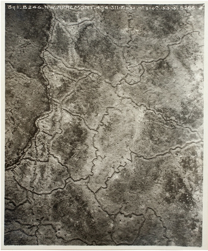
Frontline trenches (Apremont)
[World War I Album assembled by Edward Steichen]
1918, 15 May
Gelatin silver print, mounted in album
Art Institute of Chicago
Gift of William Kistler, 1977.678760, plate 50
LL/62124 [Further details available]
27 of 57
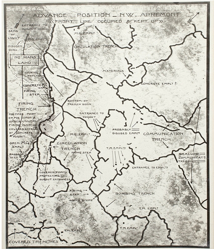
Detailed interpretation of Frontline trenches (Apremont)
[World War I Album assembled by Edward Steichen]
1918, 15 May (on or after)
Gelatin silver print, mounted in album
Art Institute of Chicago
Gift of William Kistler, 1977.678760, plate 51
LL/62126 [Further details available]
28 of 57
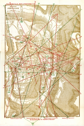
Modern Jerusalem
1900
Map
Private collection of Noja Asner
LL/79896 [Further details available]
29 of 57
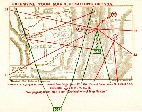
Jerusalem, Mt. of Olives and Bethany
1900
Map
Private collection of Noja Asner
LL/79897 [Further details available]
30 of 57
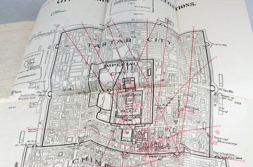
China Through the Stereoscope
n.d.
Stereoview boxed set with book
Chiswick Auctions
Mon, 28th Feb 2022, Photographica; including the contents of Studio Mexico, Lot: 314
LL/118410
31 of 57
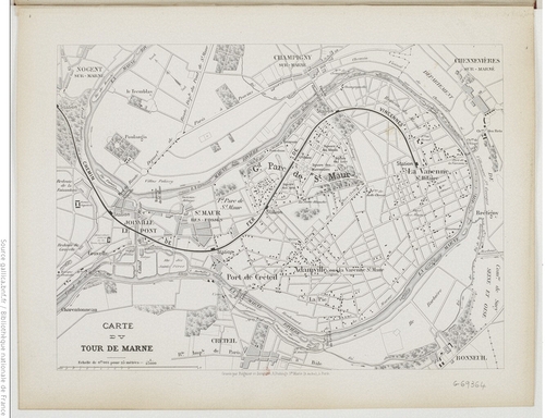
Carte du tour de Marne
[Le tour de Marne]
1865 (published)
Albumen print, tipped in
Bibliothèque Nationale de France, Département des Estampes et de la Photographie
4-VE-1445, Identifier : ark:/12148/btv1b84324442
LL/101633 [Further details available]
32 of 57
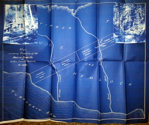
Gold mine claim of Ralph Ira Murphy on the Kenai Peninsula, Alaska
1899
Cyanotype
Private collection of David Berry?
LL/93558
33 of 57

Cover for a signed Photographic Diary with 80 images, some signed, silver prints and bromoils
[Epreuves]
1920-1922
Diary cover
29.3 x 21.7 cm
AnamorFose
Courtesy of Xavier Debeerst (Anamorfose - www.anamorfose.be)
LL/8677
34 of 57
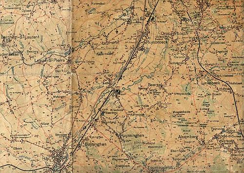
The topographical map of Brussels Lejeune used during his walks.
[Epreuves]
1920-1922
Map
AnamorFose
Courtesy of Xavier Debeerst (Anamorfose - www.anamorfose.be)
LL/8678
35 of 57
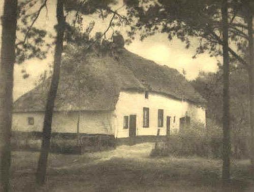
Chaume à Grimbergen
1922, 21 May
Bromoil print
36.5 x 27.8 cm
AnamorFose
Courtesy of Xavier Debeerst (Anamorfose - www.anamorfose.be)
LL/8682
36 of 57
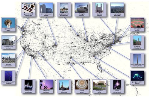
Representative images for the top landmark in each of the top 20 North American cities. All parts of the figure, including the representative images, textual labels, and even the map itself were produced automatically from our corpus of geo-tagged photos.
2009
Computer image, with added photos
Cornell University, Department of Computer Science
LL/48439 [Further details available]
37 of 57

Map of the horse-drawn tram routes of Thessaloniki with postcards
1959 (original map) 2015, 5 April (additions)
Collage, map, postcards, with hand-drawn routes
Private collection of Theodoros Natsinas
LL/61772
38 of 57
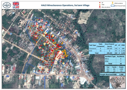
HALO Mine clearance Operations, Sra'aem Village
2017
Satellite mapping, with overlaid data
HALO Trust
Courtesy HALO Trust
LL/78515 [Further details available]
39 of 57
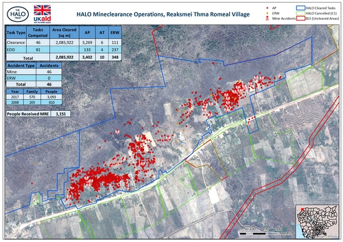
HALO Mine clearance Operations, Reaksmei Thma Romeal Village
2017
Satellite mapping, with overlaid data
HALO Trust
Courtesy HALO Trust
LL/78516 [Further details available]
40 of 57
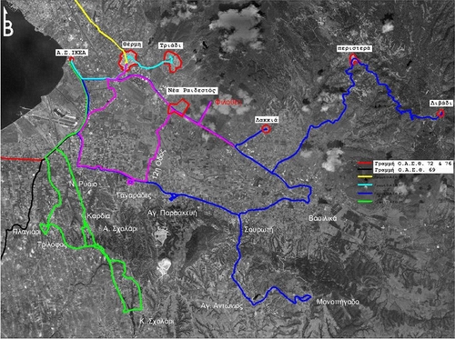
Municipal Transit; Thermi Municipality
2012
Digital image
Private collection
LL/53531 [Further details available]
41 of 57
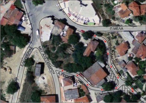
Trilofos Traffic Study
2013
Digital image
Private collection
LL/53532
42 of 57
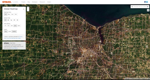
Heat map of sports activity in Rochester, New York overlaid on a digital sateillite map
2018, 30 January
Digital map
Internet - Original source ill-defined
LL/79975
43 of 57
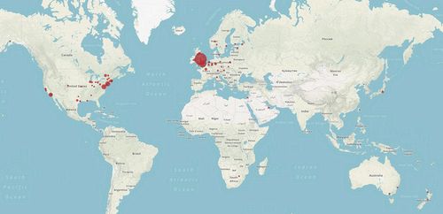
Map showing the locations of the collections where photographs by Henry Fox Talbot and his circle currently are
2018, 24 August (published)
Map, created with Palladio
Bodleian Libraries, University of Oxford
William Henry Fox Talbot Catalogue Raisonné blog. Courtesy of Jaanika Vider
LL/84988 [Further details available]
44 of 57
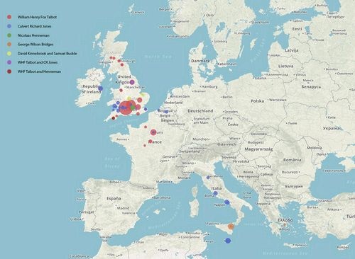
Map showing where Henry Fox Talbot and his circle took photographs (threshold more than five photographs)
2018, 24 August (published)
Map, created with Palladio
Bodleian Libraries, University of Oxford
William Henry Fox Talbot Catalogue Raisonné blog. Courtesy of Jaanika Vider
LL/84989 [Further details available]
45 of 57
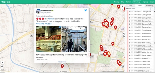
2022, 18 May
Screenshot
Internet - Original source ill-defined
LL/120134
46 of 57

2022, 18 May
Screenshot
Internet - Original source ill-defined
LL/120135
47 of 57
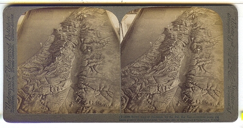
Relief map of Palestine by the Pal. Ex. Soc. - vertical scale 3.5 times greater than horizontal
n.d.
Stereocard
World of Stereoviews
LL/53561 [Further details available]
48 of 57
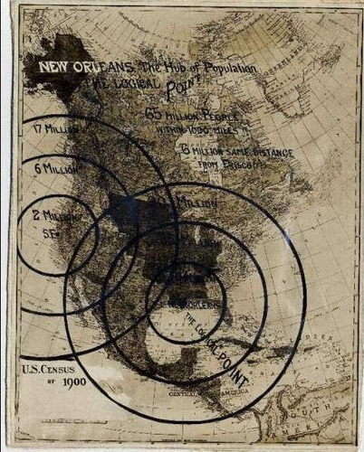
1900 Census Map with New Orleans as a Central Point
1910 (ca)
Albumen print
8 x 10 ins
Louisiana State Museum
Id: 08482.045
LL/61770 [Further details available]
49 of 57
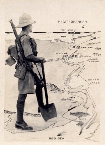
British soldier with a map of the Suez Canal
1939-1945
Photograph
Private collection of John Toohey
LL/61773 [Further details available]
50 of 57
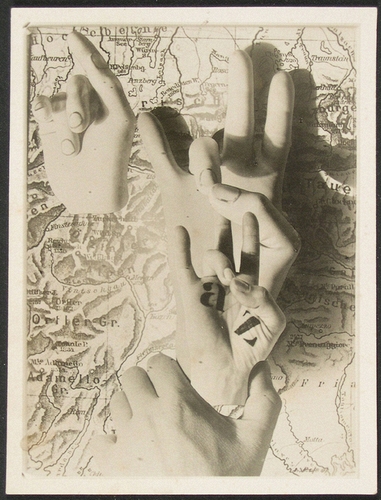
Hands Act A-Z
1931-1932
Gelatin silver print
3 15/16 x 2 7/8 ins (10 x 7.3 cm) (image) 4 1/8 x 3 3/16 ins (10.4 x 8.1 cm) (sheet)
Philadelphia Museum of Art
125th Anniversary Acquisition. The Lynne and Harold Honickman Gift of the Julien Levy Collection, 2001, Accession Number: 2001-62-406, © Artists Rights Society (ARS), New York / VG Bild-Kunst
LL/71347
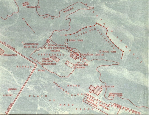
51 of 57
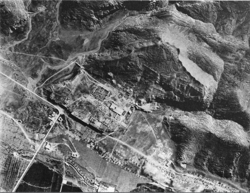
Vertical view of the site of Persepolis
1936, 20 April (taken) 1940 (published)
Aerial photograph
University of Chicago Press
LL/94066 [Further details available]
52 of 57
Vertical view of the site of Persepolis
1936, 20 April (taken) 1940 (published)
Aerial photograph
University of Chicago Press
LL/94067 [Further details available]
53 of 57

The platform of Pasargadae
1935, 28 September (taken) 1940 (published)
Aerial photograph
University of Chicago Press
LL/94068 [Further details available]
54 of 57
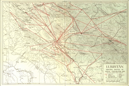
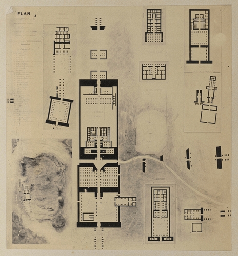
Luristan Principal Routes of Aerial Exploration 1935
1940 (published)
Map
University of Chicago Press
LL/94064 [Further details available]
55 of 57
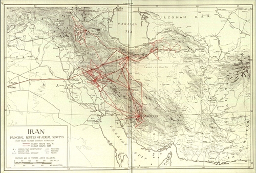
Iran Principal Routes of Aerial Surveys
1940 (published)
Map
University of Chicago Press
LL/94065 [Further details available]
56 of 57
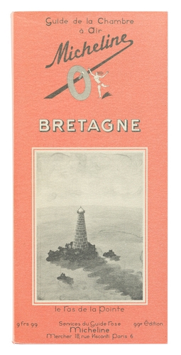
Huit Jours à Trébaumec.
1969
Folio
Swann Galleries - New York
The Virginia Zabriskie Collection, Sep 21, 2021, Sale 2579, Lot: 233
LL/113943 [Further details available]
57 of 57
57 images
Years
1839 1840 1841 1842 1843 1844 1845 1846 1847 1848 18491850 1851 1852 1853 1854 1855 1856 1857 1858 1859 1860
1861 1862 1863 1864 1865 1866 1867 1868 1869 1870 1871
1872 1873 1874 1875 1876 1877 1878 1879 1880 1881 1882
1883 1884 1885 1886 1887 1888 1889 1890 1891 1892 1893
1894 1895 1896 1897 1898 1899 1900 1901 1902 1903 1904
1905 1906 1907 1908 1909 1910 1911 1912 1913 1914 1915
1916 1917 1918 1919 1920 1921 1922 1923 1924 1925 1926
1927 1928 1929 1930 1931 1932 1933 1934 1935 1936 1937
1938 1939 1940 1941 1942 1943 1944 1945 1946 1947 1948
1949 1950 1951 1952 1953 1954 1955 1956 1957 1958 1959
1960 1961 1962 1963 1964 1965 1966 1967 1968 1969 1970
1971 1972 1973 1974 1975 1976 1977 1978 1979 1980 1981
1982 1983 1984 1985 1986 1987 1988 1989 1990 1991 1992
1993 1994 1995 1996 1997 1998 1999 2000 2001 2002 2003
2004 2005 2006 2007 2008 2009 2010 2011 2012 2013 2014
Contents - Themes & Fragments